

Have you ever wondered how professionals create stunning outdoor spaces that seem to come alive? Landscape software is the answer. These specialized digital tools empower both homeowners and experts to design intricate 2D plans and immersive 3D walkthroughs of outdoor areas before any work begins.
Modern landscape design software bridges the gap between imagination and execution. It allows users to visualize every detail, from plant placement to hardscape materials, with precision. Taylormade Landscapes utilizes advanced design tools to serve clients in Las Vegas, ensuring that every design meets the unique challenges of the desert climate.
These tools have revolutionized the industry, replacing hand-drawn sketches with dynamic digital plans that save time and reduce costly revisions. This guide will explore essential features, compare top options, and explain how digital tools can maximize rebates and comply with local guidelines.
Whether you’re planning a small backyard retreat or a large commercial project, the right software can make all the difference in creating a great design.
Key Takeaways
- Software for Landscape enables detailed planning for outdoor spaces.
- These tools help visualize designs before implementation.
- Professional-grade software accounts for specific climate challenges.
- Digital plans streamline the design process and reduce errors.
- This guide compares top software options available today.
What Is Landscape Software and How Does It Work?

Software serves as a digital workspace where users can create and visualize outdoor designs. This innovative tool allows designers to place plants, hardscapes, and structures onto a scaled representation of a property. As changes are made, they are instantly reflected in both 2D and 3D views, making the design process efficient and interactive.
The core function of the plan view acts as a top-down technical drawing. Here, designers can plot property boundaries, measure distances, and arrange elements with precision similar to CAD tools. This detailed planning is crucial for creating accurate construction documentation.
On the other hand, the perspective view offers an immersive 3D environment. Clients can see realistic renderings of their future landscape, complete with dynamic lighting, shadows, and even plant growth simulations over time. This feature enhances client presentations, allowing for a better understanding of the proposed designs.
Most professional landscape design software supports importing existing site plans, including DWG and PDF files. This capability allows designers to build directly on accurate base maps, eliminating the need to start from scratch. Additionally, users can import models from various industry-standard formats like Autodesk FBX and SketchUp SKP.
The object library within these programs is extensive. Users can drag and drop thousands of pre-modeled items into their designs, including plants, outdoor kitchens, and water features. Each item can be customized to fit the specific needs of the project, including materials and dimensions.
In residential applications, homeowners and designers use software to plan backyard makeovers, enhance front yard curb appeal, and design swimming pools with precise plant spacing. This software simplifies the planning process, ensuring that every detail is accounted for.
Commercial uses are equally diverse. Professionals can design multi-unit housing developments, corporate campuses, and parks. In these cases, the software aids in producing detailed material lists and cost estimates, essential for project management.
In Las Vegas, landscape designers particularly benefit from these tools. They model shade structures and drought-tolerant planting schemes that comply with Southern Nevada Water Authority requirements. This is crucial in a region where water conservation is a priority.
Terrain sculpting tools allow users to model sloped properties and create retaining walls, which are common in Las Vegas foothill communities. These features enable designers to create terraced landscapes that enhance both aesthetics and functionality.
Lastly, the best software automates complex tasks such as plant labeling and material quantity takeoffs. This automation saves hours of manual calculations, making the design process more efficient and less prone to errors.
What Essential Features Should You Look For in Landscape Software?

Choosing the right tools for outdoor design is crucial. When selecting software, consider features that enhance your planning and execution. The best options offer a blend of functionality and user-friendliness, making them ideal for both professionals and homeowners.
- Extensive plant database tailored for various climate zones
- Automatic plant labeling and scheduling
- Simultaneous 2D and 3D view updates
- Import/export support for CAD and 3D models
- Cost estimation and material list generation
One of the standout features is the extensive plant library. Quality design tools include thousands of high-resolution images and 3D models. These can be filtered by climate zone, sun exposure, water needs, and mature size. This is especially important in regions like Las Vegas, where heat and drought tolerance are critical for plant selection.
The plant growth visualization tool is another powerful feature. It allows designers to show clients how their landscapes will mature over time, from three months to over 20 years. This capability helps in planning proper spacing and avoiding overcrowding as plants grow.
Additionally, the simultaneous 2D and 3D design capability ensures that every change made in the plan view is instantly reflected in the perspective view. This feature eliminates duplicate work and allows designers to switch freely between technical layouts and visual presentations for clients.
Effective irrigation design tools are also essential. They allow for precise placement of sprinklers, drip lines, and piping with adjustable coverage angles and radii. This is particularly relevant for creating water-efficient systems that qualify for SNWA rebates in Las Vegas.
Lighting design features enhance outdoor spaces further. Users can visualize nighttime scenarios with realistic shadows and glow effects, utilizing products from trusted brands like Kichler and Philips Hadco. This gives clients a clear picture of how their outdoor areas will look after dark.
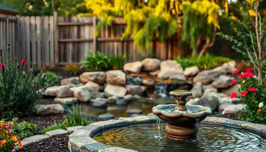
Water feature tools enable the design of ponds, streams, fountains, and waterfalls. These features can include flowing water animations, koi fish, and jumping jets, bringing aquatic elements to life in client presentations.
Moreover, hardscape design capabilities are vital. These tools assist in creating patios, decks, driveways, fencing, and retaining walls. Material libraries from reputable sources like Belgard, Unilock, and Eldorado Stone ensure accurate representation of materials used in projects.
User-friendliness is another key aspect. The best design programs include built-in tutorials, searchable help guides, and responsive technical support. This accessibility makes it easier for users to navigate without needing extensive training.
Cost estimation features streamline the quoting process. They automatically generate material lists with quantities and allow exports to Excel for easy integration of labor, excavation, and custom line items.
Lastly, import/export support for industry-standard formats like DWG, DXF, SKP, and PDF ensures compatibility with architects, engineers, and surveyors. This makes collaboration seamless across the entire project team.
In conclusion, selecting design tools with these essential features not only enhances the quality of your projects but also improves business efficiency, whether you’re working on a single-family home or a large commercial development.
How Does Landscape Software Handle 2D vs 3D Design Styles?
In the realm of outdoor design, understanding the differences between 2D plans and 3D walkthroughs is essential. Each style serves a unique purpose, catering to various needs throughout the design process. This section will clarify how these two approaches function and the benefits they bring to both designers and clients.
Differences Between 2D Plans and 3D Walkthroughs
2D plans are technical, top-down drawings that focus on accurate measurements and specifications. They typically include plant symbols, material callouts, and construction details. These plans act as blueprints for installation teams, ensuring everyone is on the same page.
In contrast, 3D walkthroughs provide immersive, perspective-based visualizations. They allow clients to “walk” through their future landscape, experiencing spatial relationships and aesthetic details as they would appear in real life. This makes 3D presentations an invaluable sales tool, showcasing how sunlight filters through trees or how outdoor lighting enhances a patio.
Benefits of Simultaneous Design Views
One of the standout features of modern design tools is the simultaneous view capability. When a designer makes an adjustment in the 2D plan, it instantly updates the 3D model. This eliminates the need to create two separate files or manually sync changes.
This dual-view functionality saves significant time on revisions. For example, if a designer changes the placement of a tree or adjusts patio dimensions, those changes automatically reflect in both views. This efficiency is especially beneficial for landscape designers in Las Vegas, who often need to demonstrate how shade structures and trees can provide relief from the intense summer heat.
Visualizing Projects Before Construction
Visualizing projects before construction begins helps identify potential issues, such as grading problems or drainage conflicts. By spotting these concerns early, designers can avoid costly fixes after installation starts.
Additionally, the ability to create 3D panoramas and video walkthroughs allows clients to view designs on their phones or share them on social media. This speeds up the design approval process and fosters collaboration. The best design tools enable designers to present multiple ideas quickly by swapping materials and layouts in real time during client meetings, turning the design process into an interactive experience.
In conclusion, combining precise 2D documentation with compelling 3D visualization gives both designers and clients confidence that the finished project will match the approved design exactly. The synergy of these approaches ensures that every detail is accounted for, leading to successful outcomes in landscape design.
What Are the Top Landscape Software Options Available Today?

When it comes to selecting the best tools for outdoor design, the options can be overwhelming. Each program offers unique features that cater to different needs. Below, we explore some of the top landscape design software available today.
| Software | Main Features | Ideal Users | Pricing |
|---|---|---|---|
| Realtime Landscaping Architect | Advanced 2D/3D, 8,000+ plant library, terrain sculpting, video walkthroughs | Homeowners, designers | $599 one-time |
| Sketchup | 3D modeling, extensive free object library via 3D Warehouse | Homeowners, designers | Free and Pro versions available |
| Land FX | AutoCAD integration, plant scheduling, photo callout feature | Professional designers | Subscription/bundled pricing |
| Vectorworks Landmark | BIM workflow, 2D to 3D modeling, construction documents integration | Professional designers | Premium pricing |
| Vizterra | 2D/3D design, terrain modeling, contractor-friendly | Contractors | Subscription-based |
| Dynascape | No 3D options, Sketchup module available | Landscape designers, contractors | Expensive |
| Bricscad | AutoCAD alternative at a fraction of the price | Designers needing CAD | Cost-effective |
Realtime Landscaping Architect stands out as a comprehensive solution. It offers advanced 2D and 3D design capabilities, an extensive library of over 8,000 plants, and terrain sculpting features ideal for sloped properties. With video walkthrough capabilities, it provides a robust tool for visualizing projects for a one-time cost of $599.
Sketchup serves as an accessible entry point for many users. Its free version includes access to the 3D Warehouse, which contains thousands of free landscape objects. This makes it popular among homeowners and designers who need quick 3D conceptualization without financial commitment.
Land FX adds unique value as an AutoCAD plugin. It enhances landscape design functionality with features like automatic plant labeling and plant scheduling that updates with design changes. Its photo callout feature pulls plant images from Google, making client presentations more engaging.
For those seeking a premium option, Vectorworks Landmark integrates pre-design analysis, schematic design, and construction documentation in a single workflow. This software supports GIS data and sun/shade studies, making it ideal for professionals who need comprehensive design tools.
Vizterra caters to contractors with its user-friendly approach. It offers both 2D and 3D design capabilities, along with terrain modeling for grade changes. Its subscription model allows users to pause payments during slower months, providing flexibility for seasonal landscaping businesses.
Other options include Dynascape, which focuses on 2D workflows and offers a Sketchup module, and Bricscad, a cost-effective alternative to AutoCAD that integrates well with landscape-specific plugins.
When choosing software, homeowners should prioritize ease of use and affordability. Sketchup or Realtime Landscaping Architect are excellent choices. Professional designers need advanced features like CAD integration and construction document generation, making Land FX or Vectorworks Landmark suitable options.
In Las Vegas, software with strong plant libraries featuring cacti and succulents is essential. Additionally, the ability to model water-efficient irrigation systems and shade structures is crucial for local projects.
Ultimately, the best landscape design software depends on specific project needs, budget, and technical comfort level. Many programs offer free trials, allowing users to test workflows before making a commitment.
How Can Landscape Software Help You Adapt to Las Vegas Climate and Local Incentives?

Las Vegas presents unique challenges for outdoor design. With summer temperatures often exceeding 110°F and annual rainfall under 5 inches, the climate demands careful planning. The intense UV exposure can stress both plants and materials, making the right choices crucial for successful landscaping.
Using advanced design tools, professionals can filter for species that thrive in USDA hardiness zones 8b-9a. This ensures that heat-tolerant and drought-resistant plants, such as desert willow, Texas ranger, agave, and red yucca, are prioritized. These selections maintain visual appeal even during the harshest summers.
Designing for Extreme Las Vegas Heat
The plant growth visualization feature allows homeowners to see how their desert-adapted landscapes will mature over time. This tool helps ensure that fast-growing species, like mesquite trees, are spaced adequately from structures, while slow-growing cacti are positioned to avoid competition.
Maximizing SNWA Rebates and Water Conservation Features
Landscape design software is instrumental in maximizing SNWA rebates. By calculating the square footage of turf grass being replaced with water-smart landscaping, designers can generate the necessary documentation for the Water Smart Landscapes rebate program. This process not only promotes water conservation but also supports financial incentives for homeowners.
Additionally, irrigation design tools enable precise planning of drip irrigation systems. These tools help determine proper emitter spacing and flow rates, ensuring compliance with SNWA’s mandatory irrigation efficiency standards. This meticulous approach maximizes water conservation, a critical need in the desert climate.
Working With Local HOA Guidelines Using Design Software
Landscape software also assists in meeting local HOA guidelines. It produces professional 2D plans that include plant schedules, material specifications, and color renderings. These documents meet the submission requirements of Las Vegas area HOAs, such as those in Summerlin, Green Valley, and Henderson master-planned communities.
Moreover, 3D visualizations help homeowners present their design ideas to HOA architectural review committees. These realistic representations show exactly how the proposed design will look from the street, demonstrating compliance with community standards for front yard aesthetics.
Terrain modeling tools are essential for handling the unique topography of properties in the Las Vegas Valley. From flat suburban lots to hillside homes in areas like MacDonald Highlands and The Ridges, these tools address critical design elements such as retaining walls and drainage management.
Working with a local expert like Taylormade Landscapes ensures clients benefit from extensive knowledge of which plants thrive in Las Vegas summers. They understand which irrigation strategies qualify for rebates and which design elements satisfy HOA requirements without sacrificing beauty.
In conclusion, landscape software is not just a design tool; it is a strategic asset for navigating the unique regulatory and environmental landscape of Las Vegas. It transforms potential obstacles into opportunities for creating stunning, sustainable outdoor spaces.
Why Do Landscape Professionals and Homeowners Choose Specific Landscape Software?

The decision-making process behind choosing design tools involves several key considerations. Landscape professionals and homeowners often weigh the complexity of features against usability, time savings, and cost-effectiveness. This balance is crucial for achieving high-quality results in outdoor projects.
Balancing Complexity with Usability
Professional landscape designers frequently opt for tools that integrate seamlessly with CAD systems, like Land FX. These programs provide precise drafting capabilities alongside landscape-specific automation for tasks such as plant labeling and scheduling. However, they come with a steeper learning curve.
In contrast, homeowners and DIY enthusiasts tend to prefer intuitive options like Sketchup or Realtime Landscaping Architect. These tools are user-friendly and come with extensive object libraries, enabling impressive 3D visualizations without requiring formal design training.
Saving Time and Cost on Design Revisions
One of the significant advantages of modern design tools is their time-saving features. For instance, when a designer adjusts a planting bed in the plan view, the software automatically updates the plant schedule and material list. This automation eliminates hours of manual recalculation that traditional hand drafting requires.
Efficient design revisions lead to cost savings for clients. Designers can explore multiple ideas quickly, present alternatives in a single meeting, and make real-time adjustments based on client feedback without starting over. This flexibility enhances the overall design process.
Presenting Designs with Realistic Visuals to Clients
Realistic visuals play a crucial role in client presentations. 3D walkthroughs that incorporate lighting effects, flowing water, and mature plant growth simulations help clients emotionally connect with the design. This connection often leads to quicker approval decisions.
However, the learning curve for various programs varies. For example, Vectorworks Landmark offers advanced BIM integration but requires significant training investment. In contrast, Realtime Landscaping Architect is designed for quick mastery, featuring built-in tutorials and responsive support.
Las Vegas landscape contractors often prefer tools that balance capability with usability. They need to produce professional presentations while maintaining efficient workflows during busy seasons. The choice between subscription models and one-time purchases also influences their decisions. Some professionals appreciate the predictability of a one-time investment, while others favor the flexibility of monthly subscriptions that can be paused during slow periods.
Taylormade Landscapes has invested in professional-grade landscape design software to deliver high-quality designs efficiently. This commitment ensures that clients in Las Vegas benefit from time savings and superior design quality.
Conclusion: Choosing the Right Landscape Software for Your Project
Selecting the ideal tools for outdoor design is essential for achieving stunning results. The right options blend precise planning with immersive visuals, making them suitable for various project needs. For homeowners and professionals in Las Vegas, software that includes robust plant libraries and efficient irrigation design tools is vital for thriving in the desert climate.
Remember, while these tools are powerful, they do not replace the expertise of a professional designer. Collaborating with an experienced local designer ensures that your vision translates beautifully into reality, addressing the unique challenges of Southern Nevada.
Frequently Asked Questions About Landscape Software
What is the best landscape software for beginners? Sketchup offers a free version with an intuitive interface and extensive 3D Warehouse library, making it ideal for homeowners starting their first landscape design project without financial investment.
Can landscape software help me qualify for SNWA rebates? Yes, professional landscape software calculates turf removal square footage and generates water-efficient irrigation plans with the documentation needed to apply for Southern Nevada Water Authority rebate programs.
How much does professional landscape software cost? Professional landscape software ranges from free options like Sketchup to one-time purchases like Realtime Landscaping Architect at $599, to premium subscriptions like Vectorworks Landmark for design-build firms.
Do I need landscape software if I am hiring a professional designer? No, professional designers like Taylormade Landscapes use industry-leading software to create your designs, but understanding the tools helps you communicate your design ideas more effectively during consultations.
While this guide provides valuable insights into software options, the best results come from combining powerful digital tools with local design expertise. Contact Taylormade Landscapes today at taylormadelandscapes.com to schedule a consultation and see how professional design software can bring your outdoor vision to life with precision and creativity.